IN Brief:
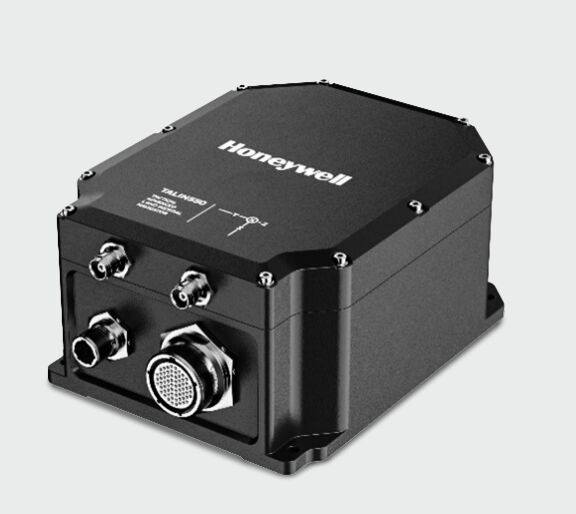
- Honeywell has unveiled the European-designed iTALIN 550 tactical land-navigation system.
- Fibre-optic gyroscopes and multiple positioning inputs maintain navigation when GNSS becomes unreliable.
- ITAR-free production is intended to simplify integration and procurement across international military programmes.
Honeywell has introduced the iTALIN 550 land-navigation system for military vehicles requiring continuous position, heading, and attitude information in GNSS-denied or electronically contested environments.
Developed by Honeywell Aerospace in the Czech Republic with its Italian subsidiary Civitanavi Systems, the unit was unveiled at the Farnborough International Airshow and is scheduled to enter full production during the first quarter of 2027. European design and manufacture leave it outside the US International Traffic in Arms Regulations.
The iTALIN 550 combines a shock-stabilised inertial-navigation unit based on fibre-optic gyroscopes with dual-antenna satellite positioning. Precise point positioning, real-time kinematic correction, and satellite-based augmentation are accompanied by anti-jamming and anti-spoofing functions intended to preserve trustworthy navigation when the electromagnetic environment deteriorates.
When satellite signals are unavailable, inertial sensors continue estimating movement from a previously established position by measuring acceleration and rotation. Honeywell specifies position drift below 0.25% of distance travelled during GNSS loss, although installed performance will also depend on alignment, vehicle dynamics, aiding inputs, calibration, and the duration and character of the outage.
Armoured vehicles, mobile artillery, air-defence systems, command vehicles, and autonomous ground platforms depend on dependable navigation for movement, weapon orientation, sensor pointing, target coordinates, and the exchange of position data with other units. Disruption at that layer can degrade several platform functions simultaneously, even when the vehicle remains mechanically serviceable.
GNSS interference has become a routine electronic-warfare condition rather than an exceptional event. A jammer can raise the local noise floor until a receiver can no longer extract the weak signals arriving from satellites, while spoofing introduces misleading signals that may appear plausible unless their timing and movement are checked against independent sources.
Because inertial navigation does not rely on an external radio transmission, it continues operating through jamming and many spoofing attacks. Its limitation is accumulated error: small sensor biases and alignment imperfections are integrated over time, gradually moving the calculated position away from the vehicle’s true location.
Fibre-optic gyroscopes offer greater stability than lower-cost inertial technologies, although they still benefit from periodic correction. Dual antennas can establish heading without waiting for vehicle movement, while RTK, PPP, and augmentation services can improve absolute accuracy whenever trusted signals and correction data become available.
Other platform inputs may extend that resilience. Wheel odometry, map matching, radar, vision, terrain references, and protected timing sources can all contribute to sensor fusion, provided the navigation computer identifies degraded information before one faulty input corrupts the complete solution.
A similar layered approach is appearing in guided weapons, where inertial navigation is being combined with scene matching, seekers, and additional guidance methods. The common engineering problem is no longer achieving precision under ideal satellite coverage, but retaining enough trusted position information after one or more external references have been denied.
Export status influences integration as well as procurement. ITAR-controlled equipment can restrict transfer, servicing, software access, and onward export even when the host vehicle and most of its electronics originate elsewhere, whereas a European-built unit gives programme authorities another route where sovereignty and local support carry substantial weight.
Qualification nevertheless extends well beyond navigation accuracy. Mechanical mounting must preserve alignment through shock and vibration, electromagnetic compatibility has to be demonstrated beside radios and high-power emitters, and the system must recover cleanly after power interruption, signal reacquisition, or a change between navigation modes.
Cybersecurity reaches into the same architecture because correction services, vehicle networks, software updates, and external aiding data all create interfaces that require authentication and monitoring. A navigation unit may continue calculating through a radio-frequency attack, yet confidence in its output still depends on the integrity of every source entering the fusion process.
The iTALIN 550 packages those functions for ground platforms expected to keep moving, pointing, and sharing coordinates after satellite navigation becomes unreliable. Assured position, navigation, and timing is consequently becoming a baseline vehicle subsystem, with inertial performance, electronic protection, software integrity, and exportability assessed as parts of one design.