IN Brief:
- GNSS 19 Click combines a Telit Cinterion SE868K5-D receiver with MIKROE's Click format.
- Dual frequency reception and Skylark corrections support centimetre level positioning under suitable conditions.
- Service availability, antenna design, radio links, and multipath remain central to real world accuracy.
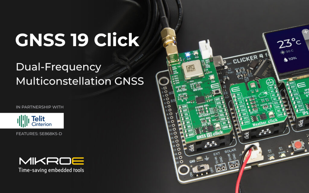
MIKROE has introduced a dual frequency, multi constellation positioning board supplied with a six month trial of Swift Navigation’s Skylark precise positioning service. GNSS 19 Click is built around Telit Cinterion’s SE868K5-D receiver and follows the mikroBUS development format, allowing several satellite systems to be evaluated without a custom RF board.
GPS, Galileo, GLONASS, BeiDou, QZSS, and satellite based augmentation services are supported. Dual frequency reception covers GPS and QZSS L1 and L5 signals alongside Galileo E1 and E5, enabling the receiver to compensate for ionospheric delay more effectively than a single frequency design.
Access to several constellations can increase the number and geometry of visible satellites, particularly in locations where buildings, vegetation, or machinery obscure part of the sky. It does not remove the effects of reflections and blockage, but it gives the positioning engine a broader set of measurements from which to build a fix.
Standard NMEA output is available alongside raw measurement data, while assisted GNSS functions include ephemeris injection and local short term prediction. Those features can reduce the time to first fix when equipment starts or returns from a period without satellite reception.
Host communication is provided through UART or I²C, with a USB to UART route for boot and development activity. The board can therefore be connected to microcontrollers, embedded Linux systems, and rapid prototyping platforms across the wider Click ecosystem.
Swift Navigation’s Skylark service supplies cloud generated correction data that can reduce positioning error to centimetre level when reception, communications, antenna placement, and local conditions are suitable. Bundling the initial service period with the hardware allows the full receiver and correction path to be assessed before a recurring service is specified.
Precision depends on the complete signal chain
Receiver capability accounts for only one part of a high accuracy GNSS design. Antenna gain, phase centre stability, ground plane geometry, cable loss, enclosure materials, and noise from processors or power converters can alter the quality of the satellite signals before they reach the module.
Correction data introduces another dependency because it has to reach the receiver with sufficiently low latency. Mobile machinery, drones, autonomous platforms, and survey equipment often use cellular, radio, or local network links; when that path is interrupted, positioning normally continues, although accuracy can deteriorate as the correction information ages.
GNSS 19 Click is intended for fleet systems, construction equipment, agriculture, drones, electric mobility, tolling, telematics, timing, and other applications that require greater confidence than standard navigation receivers provide. A production design will still need an application specific antenna, RF layout, environmental enclosure, power architecture, and communications strategy.
Satellite positioning is increasingly combined with inertial measurements because neither source is consistently reliable in isolation. An STMicroelectronics inertial sensor developed for automotive dead reckoning maintains an estimate of movement when GNSS signals are blocked, while the satellite receiver corrects the drift that accumulates within the inertial solution.
Wheel speed, steering angle, maps, cameras, and other sensors may be added where continuity is critical. The resulting fusion algorithm has to understand the confidence attached to each input, rather than treating a centimetre level correction service as proof that every reported position is accurate to the same degree.
Commercial and lifecycle questions also enter the architecture once correction services are required. Coverage territory, communications cost, account management, data format, availability, and the expected service life of the equipment all need to be defined, along with behaviour during an outage.
Raw measurement access gives developers more freedom to investigate those conditions and implement their own filters or fusion methods. It also supports detailed field logging, which helps separate antenna, propagation, receiver, and correction problems when performance changes between a clear test site and a working industrial environment.
By packaging the receiver and an initial correction entitlement together, MIKROE has reduced the effort needed to begin a precise positioning trial. The more demanding work starts after the first successful fix, when RF design, communications, environmental testing, and fallback behaviour have to preserve useful accuracy in the places where satellite reception is least cooperative.